Beyond the snapshot: a methodological approach and web-based platform for temporally dynamic ecosystem service assessments
This is my paper-based master thesis. By combining established ecosystem service (ES) research concepts with interactive geospatial visualization techniques, it introduces a novel methodological approach to enhance the assessment and visualization of temporal ES dynamics. The approach involves an initial assessment phase using a structured matrix to assess various ES within a given area over time. Following this, the TESAT (Temporal Ecosystem Service Assessment Tool), a web-based platform, is utilized to visualize and analyze the temporal ES dynamics, facilitating interactive and data-driven evaluations. The method’s application to selected water-related ES within the Salzach catchment and the Salzach river floodplain in Austria demonstrates its capacity to capture temporal variability independent of scale. While the framework shows promise, further refinement is required to facilitate its integration into existing ES assessments and practical applications, thereby increasing its relevance for practitioners and promoting informed decision-making.
Comparison of Topography-based Indices for Soil Wetness Mapping in an Austrian Floodplain Area
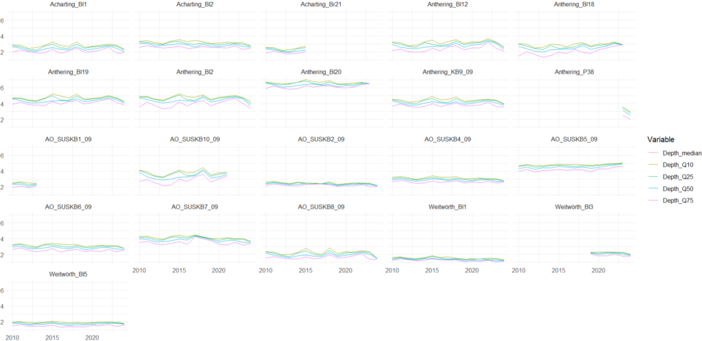
This study evaluates different ecological indicators and terrain-based indices for soil wetness mapping in the Salzach river floodplains in Austria. We utilize LiDAR-derived high-resolution DEMs (1m) to calculate the indices and compare them with field data represented by groundwater measurements. It will be submitted to a journal in 2025.
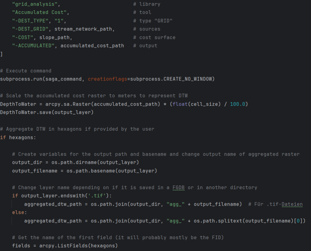
This tool calculates the (cartographic) Depth-to-Water (DTW) index, representing the simulated vertical difference (meters) between a landscape cell and the nearest surface water cell along the accumulative least-cost slope path. DTW is commonly used for soil wetness modelling and identifying areas of high or low probability of water accumulation.