Monitoring Refugee Movements With a Dashbaord Integrated In a Modern and Effective Spatial Data Infrastructure
Keywords: Sudan crisis, SDI, interactive dashboard, PostGIS, OGC WMS/WFS, ISO19139, metadata catalogues, project management, GitLab.
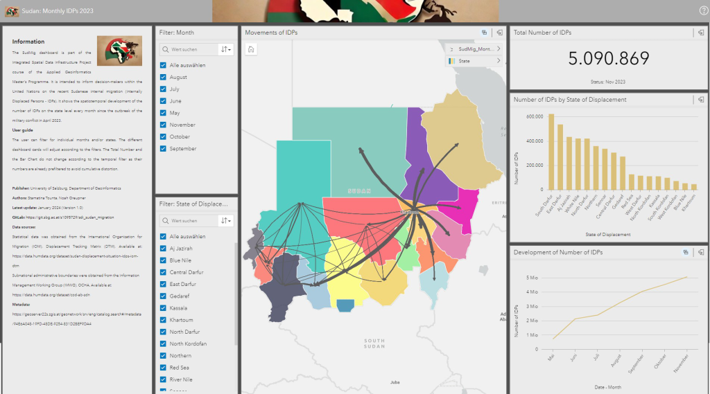
Summary: The project focussed on developing an interactive dashboard using a Spatial Data Infrastructure (SDI) to facilitate standardized data storing, sharing, and managing. To establish the dashboard, migration datasets and administrative boundaries of Sudan were obtained from the United Nations, pre-processed, and stored in a PostGIS database. Subsequently, OGC-compliant Web Services (Web Map Service and Web Feature Services) were published and used in ArcGIS Insights to create a dashboard. This dashboard showes the Internally Displaced People (IDPs) in Sudan which were forced to flee from home due to the military conflict which started in April 2023, causing the world’s largest internal migration crisis. The project management was conducted using a Gantt chart, GitLab issue tracking, work breakdown structures, and time tracking. Click here to access the dashboard, here to explore the related project GitLab repository and Wiki, and here to view the WFS metadata.
Software: PostGIS (PostgresSQL extension), ArcGIS Pro, ArcGIS Insights, MS Excel.
